Wellness
The hidden nature walks locals love but tourists miss
Newcastle's most rewarding outdoor fitness tracks are tucked away from the postcard shots — and the regulars who use them every week prefer it that way.
4 min read
Updated 3 h ago
Wellness
Newcastle's most rewarding outdoor fitness tracks are tucked away from the postcard shots — and the regulars who use them every week prefer it that way.
4 min read
Updated 3 h ago

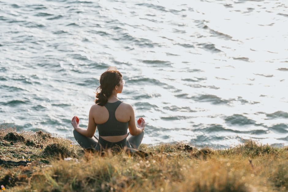
The Bathers Way gets all the attention. But on any given Tuesday morning, the real action is half a kilometre inland, where a steady stream of locals pace the sandstone ridge trails of Glenrock State Conservation Area without a tourist in sight.
Newcastle's outdoor fitness culture is thriving — and increasingly, it's moving away from the headline coastal strip and into the lesser-known green corridors that thread through the city's western and southern edges. With winter daylight hours compressing morning routines and gym costs continuing to bite household budgets, free public trail networks are logging record foot traffic. Glenrock alone, managed by NSW National Parks and Wildlife Service, covers 370 hectares of bushland beginning at the bottom of Fernleigh Track near Whitebridge, yet it rarely features on any visitor itinerary.
Glenrock's internal loop system — accessible via the Awabakal Drive entry point in Adamstown Heights — runs to roughly 14 kilometres of interconnected firetrail and singletrack. The terrain shifts from coastal heath to eucalypt forest within minutes. Dog walkers, trail runners and bush walkers use it before 8am most days, and the car park off Victoria Street fills by 7:30am on weekends. It costs nothing to enter.
Further north, Blackbutt Reserve in New Lambton is another local staple that visitors consistently overlook. The 182-hectare bushland reserve, managed by Newcastle City Council, contains marked walking trails ranging from a flat 1.2-kilometre accessible loop to steeper ridgeline tracks that connect to Richley Reserve. Council upgraded the signage network there in March 2026, making it easier to navigate the longer circuits that exit near Lookout Road. The reserve is open daily from 7am.
Both spots sit within 10 minutes by car from the Newcastle CBD, yet they draw almost exclusively local users. The contrast with Nobbys Beach or King Edward Park — where visitor numbers have climbed sharply since the Hunter Valley tourism rebound of 2024-25 — is stark. Locals have quietly gravitated toward green spaces that offer genuine solitude, elevation change, and the kind of unstructured movement that fitness researchers increasingly link to improved mental health outcomes.
A 2025 study published in the journal Environmental Health Perspectives found that adults who walked in natural bush settings at least twice weekly reported a 22 percent reduction in self-reported anxiety scores compared with those who exercised exclusively on paved urban paths. That figure has circulated widely in local fitness communities, including among the coordinators of the Newcastle Bushwalkers club, which has operated since 1947 and runs guided walks from Merewether to the Watagans most Saturdays. Club membership passed 600 registered members in January 2026, its highest figure in a decade.
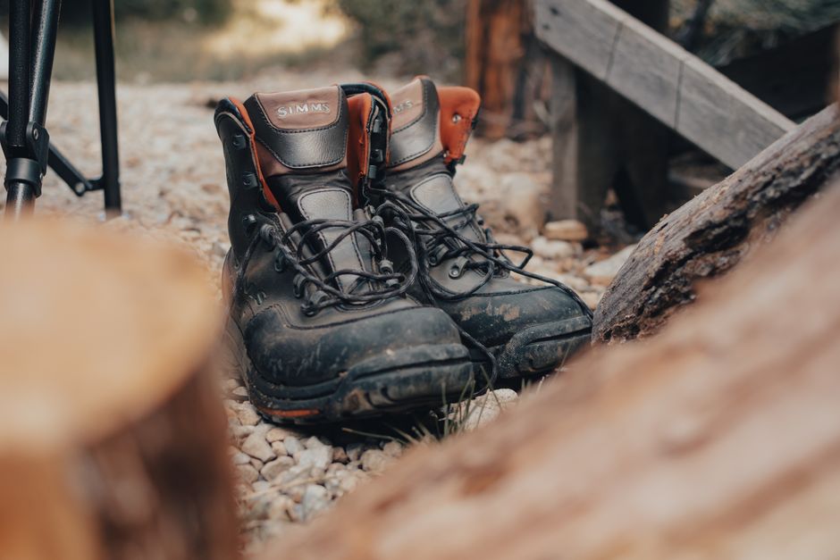
The winter months tend to sort committed trail users from casual visitors. Temperatures in Newcastle drop to around 9 degrees Celsius on July mornings, and the bush trails become genuinely muddy after rain — conditions that deter the uninitiated and, for regulars, add to the appeal. Good waterproof trail shoes are a practical necessity; the firetrail surface at Glenrock turns slick quickly after even light rain.
For anyone wanting to start, the Fernleigh Track — an 8-kilometre paved rail trail between Adamstown and Belmont — serves as the most accessible entry point into the broader trail network. It links physically to Glenrock at the Whitebridge end and is illuminated for early-morning use. Newcastle City Council's Tracks and Trails map, available free at the Civic library on Laman Street, covers 23 separate routes within the local government area.
The practical advice from experienced users is simple: go before 8am, carry water even in winter, and download an offline map via AllTrails before you lose phone reception on the ridge. A consultation with a GP or exercise physiologist at one of Newcastle's community health clinics is worth considering before tackling the steeper Glenrock circuits for the first time, particularly for those returning to regular exercise after a break.
Wellness
Wellness

Wellness

Wellness
About this article
Published by The Daily Newcastle
Spread the word
Daily brief
Free, in your inbox before 7am. Weekdays.
The Daily Network — local news across Australia